Tuesday we took a day trip down to Durango and back. On the way South we took 550. This road has some great views, fun curves, and the road is in tip-top condition. The only drawback is the heavy traffic which took away a lot of the fun. But it was still a good experience. No pics of this part due to road rage.
<imagine photo of amazing scenery and heavy traffic>
On the way back up North we took 145. This road was fairly nice as well, but we got DUMPED on by a thunderstorm. Not only did this slow us down to a crawl, but we also had to cross a few rivers of bright red mud that were washing over the road. No pics of this section due to heavy rain.
<imagine photo of 20 feet wide, 8 inches of red mud covering highway>
To celebrate getting back to the cabin we put on some dry clothes, had some fried fish from what we caught yesterday, and did nothing. And it was great.
View Larger Map
Trip miles to date: 1,303
Tuesday, August 2, 2011
Leaving Moab
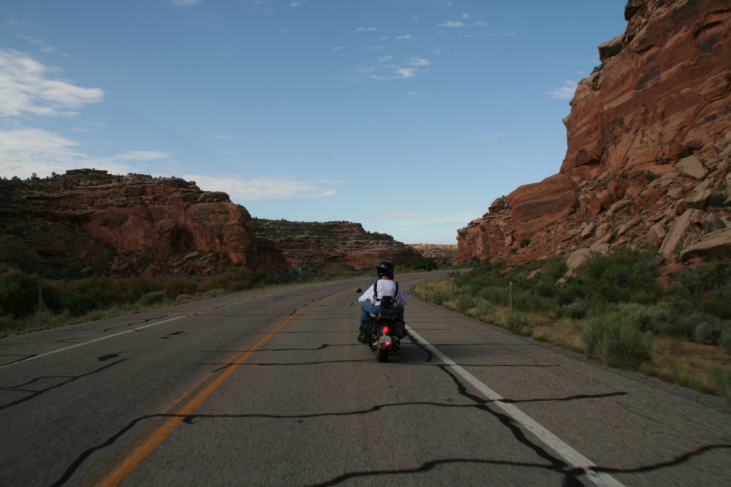
Monday morning we got on the road early to take the LONG way back to the cabin. We drove up into the La Sal mountains and then back north to follow the Colorado river up to I-70.

View of Colorado River valley coming down from La Sal mountains.

When we got back to the cabin we headed out to the lake for some trout fishing. We were able to catch rainbow and brown trout. Definitely got enough to feed everyone for dinner.


Raider Red is not a good fisherman, luckily I did pretty well.
The evening brought out some wonderful stars. At 10,500 feet, and 50 miles to the nearest city, the night sky at the cabin is incredible.

Bike in the foreground of the night sky.

Here you can see the silhouette of the trees in front of the cabin.
View Larger Map
Trip miles to date: 910

View of Colorado River valley coming down from La Sal mountains.

When we got back to the cabin we headed out to the lake for some trout fishing. We were able to catch rainbow and brown trout. Definitely got enough to feed everyone for dinner.

Dave pulling in a keeper.

Raider Red is not a good fisherman, luckily I did pretty well.
The evening brought out some wonderful stars. At 10,500 feet, and 50 miles to the nearest city, the night sky at the cabin is incredible.

Bike in the foreground of the night sky.

Here you can see the silhouette of the trees in front of the cabin.
View Larger Map
Trip miles to date: 910
Monday, August 1, 2011
!MOAB!
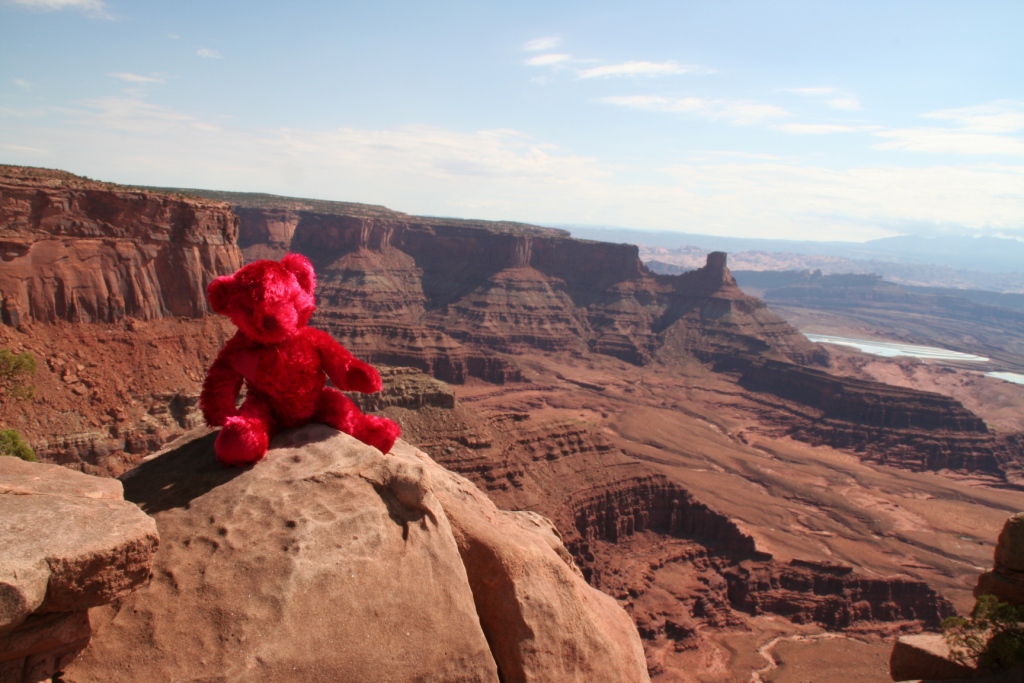
Sunday we decided to start the day by riding out to some canyon overlooks in Canyonlands National Park. First we went to Dead Horse State Park. With a very narrow pass, and sheer cliff walls on all other sides, this was the perfect place for cowboys to corral wild horses. They would drive herds of horses out onto this point, and then build a fence across the narrow strip of land to keep them in. Legend has it that a herd of horses died of thirst within view of the Colorado river, 2,000 feet below.

My parents came along with us for a few days.


Raider Red is my traveling buddy. No, I do not need to him to sleep.
After Dead Horse we headed to Canyonlands. Here, my parents took off on a tour of this amazing national park, while Dave and I headed off the beaten path. We took a dirt trail from the top of the canyon rim down to the bottom. It was a 30 mile trip that took us back into town, with a LOT of demanding trails, but with views that more than made up for it.


Dirt road with 1,000 cliff drops!


Dave on the edge!

This is the gravel road we took down from the rim to the base of the canyon. I'm not gonna lie, I was a little intimidated.

Desolate.

Amazing rock formations.

This is my "WTF?" look.

Another view of the steepest part of the trail.


Overlooking the Colorado River, about halfway down the 2,000 foot canyon.

View Larger Map
Trip miles to date: 715
To Utah
After a bacon and egg breakfast, we headed to Land's End at the top of Grand Mesa.


The ground squirrels and chipmunks are almost tame, and love to eat peanuts and sunflower seeds.


Then it was west towards Moab, UT. First stop was Arches National Park. It was HOT but it was great. The scenery and the rock formations are insanely gorgeous. Can you see any faces in the rocks?


View Larger Map
Trip miles to date: 620


The ground squirrels and chipmunks are almost tame, and love to eat peanuts and sunflower seeds.


View Larger Map
Trip miles to date: 620
Subscribe to:
Comments (Atom)